Showing posts with label Mountaineering. Show all posts

Thursday, 5 March 2015

Sunshine, Mountains and Cloud Inversions!

The Lakes in early February

The Lake District trip earlier this February was one of my favourite UBES trips. We were lucky to have beautiful sunshine all weekend, basically no wind and the not-yet-melted snow from the flurries the week before to play in (a great combo).


Saturday morning’s drive from Thirlmere to Glenridding was spectacular: low morning light and misty fields. From there, a group of us tackled Striding Edge, bumping into another group at the summit of Helvellyn who’d walked up from Thirlmere. Striding Edge was in basically summer conditions, with no ice and patchy snow; we felt a bit silly in our crampons!

We met a woman who reminisced of her student days, when her university hiking club would hire a minibus from their union for £5 for the weekend, fuel included! How times have changed.


Looking down onto Red Tarn from Red Tarn Cove (spot the UBESters!)


…Some things will never change, and we stopped at Red Tarn, after descending via Swirral Edge and a snowy, bum-slidy gully, for an inevitable lake bag. This involved hacking through 4’ thick ice and very little dignity. Luckily, Hugo’s Jetboil restored some warmth to icy limbs.

Alex’s pleasant afternoon dip


In the midst of these naked antics, we spotted Laurence, Ben and Duncan on V-Corner (III) on Red Tarn Cove.


The boiz on V-Corner (III) on Red Tarn Cove


Another group had a brilliant day on Blencathra, via Sharp Edge (involving equally heroic *assisted* (people lowering other people into icy water holes…!) lake bags), and another an ‘awesome’ epic, doing a long loop encompassing Langdale Pikes, Bow Fell and Crinkle Crags.


Team Sharp Edge


On the Sunday, Striding Edge and Sharp Edge were revisited, along with some some lower level walks. It was another beautiful day, with stunning cloud inversions.

What a weekend!


For more photos check out our Flickr page!

Tuesday, 27 January 2015

Snowdonia 2

This weekend, forty of us set off for a wintry weekend in Snowdonia. In case anyone was wondering what we got up to, I thought I’d write a brief trip report! 
Going crazy on the Carneddau
On the Saturday, ten of us optimistically set off up the Miners’ track in search of a winter climb on the Trinity face of Snowdon. Despite the thaw the day before, we found Central Trinity in slightly slushy, but climbable condition.

One party soloed, and two parties roped up for the snow gully, which cuts straight up from Glaslyn to the top of Snowdon. It had a chockstone and a teeny bit of almost ice to give interest, and it was great to get the axes out. We were slightly bemused when we topped out to see crowds of people crawling up to the summit in trainers, and then sliding back down again.


An intrepid group of UBESters on the wintry Glyders
Other walks took on the Carneddau and the Glyders, finding plenty of wintry excitement and a fair bit of scrambling too. Tim lead one of his classic slogs, taking in twenty kilometers of epic Welsh hills, and returning late enough that people were talking about getting in touch with Mountain Rescue (It's okay; they were either joking, or had had a considerable amount to drink). 
We all returned ready for a nourishing dinner, however we were not aware that disaster was about to strike. A hole was discovered in the rice pan. The starchy water gushing onto the stove somehow managed to ignite, creating a small fire and a lot of excitement. After consuming copious quantities of delicious slop, cooked at last, the Saturday evening contained its usual dose of organised fun, a bonfire and a disco! 

One of the climbing officers gearing up for a very serious climb
On the second day, which was warmer, wetter and windier, several groups set off to take on some of the smaller peaks. A group of twenty took on Moel Siabod, some of us attempting to run it, to greater and lesser degrees of success. Other walks included a miniature 'three peaks', involving the all important driving aspect of the more grandiose UK wide challenge.

There were many lakes bagged this weekend, one of the more ‘heroic’ ones on the Sunday walk up Cnicht, was described by the bagger himself. “It was too shallow so I had to wade out into thigh deep mud, and the weather was like a moist apocalypse, but less exciting.” Sounds like great fun!I had a great weekend; I really hope everyone else did too.

A massive thank you to everyone who helped organise it, and I look forward to seeing everyone soon!
A postgrad officer looking like a pro!
Topping out on the summit of Snowdon


Saturday, 26 July 2014

Alpine Adventures–Conville Course

10489845_10204461257675125_3570183307635636396_n

This summer I travelled out to the French Alps for my first ever foray into the world of slightly higher altitude mountaineering. I was lucky enough to be able to take part in a Conville course. The Jonathon Conville Trust was set up in memory of the young mountaineer who it was named after, who died on the Matterhorn in 1979. They provide subsidised courses in the Alps, among other things, which are aimed at helping young mountaineers start their alpine career safely, with knowledge of techniques such as crevasse rescue and safe rope work over technical ground.

So I packed up my bags and headed out to Chamonix, to live off a diet of tinned food and cheese, and far too few showers, for my first alpine season.

10430910_10154378272115217_8010297258919395377_n

On the first day of the course, after a quick briefing and kit check, we caught the Montenvers railway up onto the Mer de Glace, to practise crevasse rescue technique and roping up. The day started with the descent of over 250m ladders, to get us down to the level the glacier had retreated to. We watched with envy as groups of school kids marched out with us. Why didn’t my school do that! We were greeted at the bottom by the cool breeze off the glacier, and the smell of ice. Crevasse rescue turned out to be fairly fiddly and tiring work. We split into teams, three Convillers to a guide. Our guide taught us how to improve the system to make it efficient as possible, but I still reckon I’d have a hard time pulling someone out. As one of the lightest, it seems likely I’ll fall into the role of crevasse poodle (literally).

10306077_775265819160646_4981034402260960471_n

The second day we caught the amazing Midi lift (the third most visited tourist attraction in the world), up to the grand height of 3800m at the top of the Aiguille du Midi. We started by roping up in the famous ice cave entrance, and then slowly tiptoeing our way down the thoroughly exposed Midi arĂȘte. The day was spend applying the previous day’s learning, doing the first two points on Pointe Lachenale (one of them is definitely more of a bump), and slowly acclimatising to working at altitude.  

IMG_0793The third day we made our first attempt at a route, in the slightly lower Aiguilles Rouges. The three of us moved together, along the Traverse of the Crochues, a PD+ ridge, while our guide soloed alongside us, cajoling us along, so as not to turn the trip into a faffalanche. It turned out at the abseil that two of us had taken the motto ‘fast and light’ too far, and our guide was not impressed by the lack of belay plates, so we were plied with his and told to be snappy. Climbing in big boots turned out to be a lot of fun, and also surprisingly practical, in stark contrast to my pre-Alps practice in the gorge, which as by all accounts, traumatic. All in all, it was a fantastic route, covering lots of interesting ground, surrounded by amazing views of the Mont Blanc Massif. To top it all off, there was enough snow for a speedy descent, practising both our skiing, and more often than not, our bumsliding. 

Over the next few days I spent plenty of time watching the rain gush down the windows of the refuge, and studying various ambitious routes. When the sun was shining, I did manage to fit in the Cosmiques Arete, an exciting variation on Pointe Lachenal, some long mountain sport, an epic valley level ‘grade 3’ scramble, and some ice climbing on the Mer de Glace. I had a great time and I can’t wait to get out there next year.

10469729_10154378274340217_2222889875373880769_n


More information about the Jonathon Conville Mountaineering Trust: http://www.jcmt.org.uk/

If you want to see how little it has changed, this is an article my friend wrote 11 years ago (Midnight Express has been a thing for that long, and you still can’t get it in every cafĂ© in Wales?!!): http://www.jcmt.org.uk/wp-content/uploads/2011/05/Summit_37.pdf


Rebecca Millington

10479604_10204438416184102_4787749093673889982_n10364160_10204438417184127_6553443806402568500_nIMG_0802IMG_0809IMG_0820IMG_0804

10492550_10204461279955682_5370986900347434020_n

Wednesday, 11 June 2014

Notice for the Appointment of UBES Honorary Presidents

This year we have made the decision to appoint two individuals to the position of UBES Honorary President. This is a purely ceremonial award to recognise the significant contribution an individual has made to the society over a number of years or to expeditions taking place outside of the UK.clip_image002

George Cave

George was originally a kayaker at university before making the switch to mountaineering. He spent a number of years on the committee, one of which as President and he still continues to add value to the society by returning and joining us on trips. Over the past three years, George has been fortunate enough go on two overseas expeditions. One to the Russian Altai, which he organised and led and then more recently the high profile expedition to the Djangart region of Kyrgyzstan. Both expeditions saw world first ascents achieved. With the undertaking of these expeditions and multiple ‘67hour’ adventures we feel that George truly embodies the sense of adventure that UBES strives to develop and nurture.

Robert Wragge-Morley

clip_image004Rob has been involved with the society ever since he first arrived at Bristol and has been on the committee more times than I can remember and was also President for a year. Initially a very keen climber he soon became an active member of the society before moving towards more general mountaineering, including becoming an avid winter climber. In the past few years Rob has particularly pursued weekend hits to mountainous areas when winter conditions are ‘in’ along with an avid appetite for alpine climbing and exploring new mountain ranges. Most recently Rob and a fellow UBES member attempted to climb Mount Olympus in rather challenging conditions as part of an exploratory trip round the relatively unvisited mountains of Greece. One of the greatest contributions that Rob has made to the society over the years that he has been here is in passing down both his mountains skills and experience. This is something that he has done almost selflessly by running multiple training weekends and days. It is Rob’s wanting to explore and willingness teach and help younger members that we feel embodies the mindset of UBES.

The contribution to UBES and exploration within young people by George and Rob cannot be underestimated and it was an easy decision for us to bestow this position on both of them.

Will

Wednesday, 7 May 2014

Greece Part Two: Adventures in the Southern Pindos

More from Rob and Tom on their Easter Adventures to keep you distracted during revision:

After Olympus, we had one day of organising our gear and food and travelling and then a bad weather day in which we discovered an amazing piece of culture that we’d only had a very vague prior idea about, the Monasteries of Meteora. All this left us with one, possibly two days to explore the area of the Southern Pindos in which we found ourselves. We had already seen the dramatic, snow covered mountains all around Elati, Nikolas had pointed some of them out to us when we met on the night we arrived. Modest and unassuming, Nikolas must be at the forefront of mountaineering in Greece. He knows the hills of his own country very well indeed and works hard to promote hillwalking and mountaineering in the the country via the website Hellaspath. He has also coordinated numerous expeditions to more exotic destinations, especially the mountains of Northern Pakistan and India. From the panoramic windows of his cousin’s restaurant in Elati, he had recommended a ridge traverse immediately to our South, beginning on a hill called Mavropouli and continuing over Loupata, Marosa and Avgo. This would take two days and whilst it was largely walking, contained some technical sections. He advised against it should the weather be poor, so it was with disappointment that we woke to rain on Wednesday morning.

Night-time view from Elati


Not to be defeated however, we set off in clean air on Thursday morning to tackle the centre portion of the ridge, with the most technical interest, gaining Loupata from the North and Continuing over Marosa for as far as time allowed.

We rose early and drove on tiptoes through the dark mountain roads to the place Nikolas had recommended we park. We left the car at a junction on a minor road and continued on foot, down over the river and up through a small clearing to a left turning hairpin where we struck off up the ridge into the forest.

The road in the morning
Light in the trees
There are no paths in these fir woods, and though managed to a point they retain quite an open natural feel. From time to time the way we took looked almost path like, at others we were pushing through low branches and staying as close as we could to a vague ridge-line in the trees. The darkness was punctuated by dappled sunlight and little sound as we climbed steeply away from the river. We crossed a couple of forest roads and by and by the little clearings became more frequent and the trees grew thinner and shorter and we found more and more exhilarating little glimpses of view to either side of the spur we were climbing.

Forested ridges

Breaking out of the trees on to the open mountainside we were confronted with a spectacular scene. We had already been walking on snow for some hundreds of metres and the rounded spur on which we stood was oddly reminiscent of the English lake-district or one of the softer corners of the Scottish highlands. Away to the East and West, however, were snippets of mountains from different continents, the forested ridges of the Appalacians capped with the rugged crags of the Rockies to the North; the lochs and Glens of Scotland to the East and West providing a footing for great snow-covered alpine peaks and dry golden limestone crags like those of the Pyrenees or Vaud Canton. All around was row after row of mountains marching off in ever receding shades of blue as far as the eye could see.


Distant Mountains
The view to the saddle
As we climbed higher, exchanging the lead on almost perfect virgin neve, punctuated with the occasional deep drift, the scale and wilderness of this place became increasingly apparent. Though we were not far from roads, they were clearly seldom used, and even less frequently been strayed from and as the spur we were on joined the main ridge that swept up from the saddle below Mavropouli, it became clear that we were the only people to walk on this mountain certainly since the presently lying snow had fallen, and given its consolidation that could be months.

Tom breaking trail


Loupata is a rounded mountain on this side, a plateau with three great curving summits rising up from it, each like a miniature version of Skiddaw when viewed from our side, but steeper – in less perfect snow conditions, the going would be hard indeed. The further side of these peaks however was steep and craggy, vast cliffs as large as any mountain crag in the UK formed what from the South would be a solid wall of mountain holding back these peaks and making elegant swooping ridges between them. The crags were steep, shattered golden limestone kissed with rime-ice and harbouring a few small trees here and there.
Descending Loupata
The main ridge looking back to Loupata
We progressed across snow so sturdy we barely marked it, following the undulations of the ridge, the vast country lay spread out below us on both sides. The expanse and lonely beauty of this place were wonderfully uplifting, and seemed to brush away the occasional tongue of cloud that washed over the mountains. The further round the skyline we travelled, the more dramatic the cirque on the steep side of the ridge became, though unlike the northern side it was largely devoid of snow. At last we came to a subsidiary summit some distance from Loupata where we must descend the top of the steep crags to continue on the ridge, the correct descent line is via a vague rocky couloir which is hard to follow from above, though we found the incut top of it fairly easily. We downclimbed for four pitches of our 30m rope, winding down broken, vegetated mountainside and belaying each other where we could until we reached ground shallow enough to walk on where the onwards ridge protruded from the base of the crag.

Tom on a belay


This last episode took far longer in reality than it did to describe, whereas the opposite is true of the spectacular views from the ridge above. We probably spent an hour and a half taking turns to shiver on dubious belays whilst the other picked their way delicately down through crags and scruffy bushes, with the odd surprisingly technical move on fairly friable limestone. If for a moment one were to face out from the crag, the view along the wall of steeper cliffs bounding Loupata’s southern flank made a spectacular frame for the surrounding landscape.

During our descent, the lower clouds had dissipated, giving us our first view of Marosa, the next mountain in the chain. Its main summit is a vast round topped pinnacle, surrounded by steep walls of rock, sometimes undercut and linked to the main ridge via a short but exceedingly steep ridge. The more accessible summit on which a man-made triangulation pillar stands, was linked to where we stood by another long, elegant ridge, with cliffs once more to our left and rolling, but often steep snow-fields to the right. The limestone mountainside here is full of small twisted crags and sink-holes, pointing to a landscape that is still quite actively shaping its own destiny.

Marosa


Bear tracks in the snow
Until this point in the day, we had clearly been completely alone on the mountain, but now as we looked along the ridge there appeared to be a set of footprints coming up to the saddle. In the bright snow it was hard to make out exactly where they came from or went to, but it was clear that we were not the only ones to traverse these hills in recent days as we’d thought. However as we approached the trail, the spacing, though man sized, was noticeably uneven, and on arrival in the saddle, we found that no human had made these tracks, unless they had scaled the cliff behind us and descended towards the crags and forest below; heading out of, rather than in to the wilderness. They would also have had to possess several large claws on each foot.

After further observation and concluding that these tracks disappeared behind a crag but did not reappear on its further side, we made as much haste as we could up on to Marosa, in order to put as much ground as possible between us and what could logically only be a bear, occasionally scanning the vast snow field below for any moving shape, but there was none, though in our minds eyes any of a number of boulders might have shifted itself slightly, dozing in the mid-afternoon sun.

Even Marosa’s more rounded summit was a steep affair, and the chord linking it to the rocky tower seemed uninviting given the time of day. Seeing black clouds looming in a vast sprawling mass behind Avgo as that final mountain in the chain came into view confirmed our decision to skip it out, continuing the ridge would require us to descend into the vast corrie between us and Avgo in any event, and if the weather looked unlikely to improve we could descend the valley that it fed. A direct descent from the summit seemed infeasible, so we descended a gentle ridge to the North for about fifty metres before heading downhill into the corrie.

Approaching Marosa
Marosa's isolated main summit
This descent probably took no more than 15 or 20 minutes but it could have been hours or even days of carefully picking a way down steep snowfields and through little crags, sometimes walking normally to traverse from one area of clear snow to the next, but mostly facing in to the hillside, which for the middle 100m or so of descent must have been rather steeper than 40 degrees and necessitated careful kicking of pigeon-hole steps, a tiring and time consuming process. In places on this hillside the snow was soft from the warmth of the day and not especially deep. The debris on the corrie floor suggested that most of the winters snow cover had avalanched from this hillside and what we were cautiously slithering our way down was the result of a couple of recent large falls. In the first snow field we were startled by a solitary peal of thunder from over Avgo, and though we heard no more, this only acted as an encouragement to gain more stable ground quickly.

Tom on the descent


Having safely negotiated this leg of the journey we found ourselves in a vast bowl reminiscent of the Grey Corries but on scale so much greater it is hard to describe – double the linear dimensions and the mountains feel of a different order of magnitude. We had spied out the shepherds hut that would have been a bivi spot if we’d done the entire ridge traverse and headed for that not wishing to be caught out, even on a peak as amenable as Avgo appeared from a distance.

Avgo

Hellebore
Crossing a stream

Shepherds Hut


We splashed through rushing meltwater streams where the tongues of snow ended and crossed wild alpine meadows, rich with nodding hellebore and golden king-cups, and by the hut joined a mountain road. The road dived almost immediately into steep forest, clinging to its shallow topsoil and frequently revealing twisted limestone strata like a section through a badly folded blanket. This road had not yet been opened for the summer and sections of it remained blocked by the winter’s landslips and avalanche debris. This high up it was still only just spring. The cuttings where the road had been laid on the hillside seemed keen to dislodge rocks on the unwary traveller and we made our way past them fairly briskly. Occasionally we would turn and look back, we were following another of Greece’s magnificent gorges, this one wreathed in cloud and eerie in its remote splendour. The rivers we had crossed on the mountainside as streams and again as wide rocky fords as we entered the wood now thundered below us through inaccessible rocky alleyways and breaking the surface of deep tree-locked pools.

Rain


The road became recognisably more like a forestry track as we descended, and there were even the signs of some human activity, and once in the forest proper it began to feel like a very long road indeed. We marched on in the rain, through the ruts of large forestry vehicles until we at last wound our way down through a series of hairpins to the big valley out of which we had climbed.

Forest road

Once on back on the more major dirt road in this valley, we covered the final 5.2km in just over an hour, winding our way back up the river, watching it decrease in size and activity as we went. We were focussed simply on returning now. It was late and there was little light left and it had been raining for several hours. We had been so engrossed in making progress over the mountains that we had neglected to pause for proper food all day, and so it was wet and exhausted that we came over the last little summit in the road to find the car parked up by the junction waiting for us. In thirteen and a half hours we hadn’t seen another human being, though we’d been within a kilometre of a village when we reached the road. These mountains are very remote and wild, and we had used all of the available light that day exploring a very small piece of them.


After wearily eating the food we had intended for lunch as a makeshift dinner, we drove ourselves back to Elati through the heavy snow that was now falling, and were kindly received at the hotel Kroupi. After two nights of roadside camping and what had felt like the hardest day of the trip a hot shower and proper beds were most welcome before the journey home began on Friday morning.

Tuesday, 22 April 2014

Greece Part One: Mount Olympus, Sea to Summit to Sea

Tom Hill and Rob WM recently took a trip to the mountains of Northern Greece, here is Rob's take on the beginning of their trip:
Mount Olympus, the home of the Ancient Greek Pantheon, Visible from the cities of Larissa to the South and Thessaloniki, in the old Kingdom of Macedonia across the bay. Its summits often wreathed in cloud, the mountain rises up out of the blue waters on the Mediterranean Sea and soars in to the heavens. About its feet the little pan-tiled villages and shady olive groves that lend rural Greece a picturesque quality, rather like Cezanne’s paintings of France and Spain.
Seaside ghost town
Camping Chalets
View of the mountain
At 2918m, Olympus is the highest mountain in Greece and stands about 18km from the coast at Plaka Litochoro as the crow flies. The first three days of our trip to Greece were spent walking from the edge of the sea to the summit of the highest of the major peaks of Olympus, Mytikas, and back again.
Olympus is a big mountain massif with several refuges on its flanks. Most of these are not open in the early spring so it was decided early on that we would make use of refuge ‘A’ which is the closest to Litochoro and low enough (2100m) to make a sensible target for a first day starting from the sea at Plaka. (The open refuges are on the Muses Plateau at 2700m). The way to this refuge follows the Enipea river through a limestone canyon of gargantuan proportions and should provide a dramatic entrance to the range. From refuge ‘A’ we would summit, and then descend on the third day, possibly by crossing to the higher ridge on the north side of the Canyon to begin the descent.

A frenzied week prior to leaving saw various pieces of equipment being acquired and organised and myself and Tom packing our shared hold-luggage bag in my lab in Queens Building on Wednesday. On Thursday evening we left on the latest possible train to Stansted and spent a miserable few hours in the airport before the gate to our flight opened at about 5 on Friday Morning. Friday afternoon was dull and slightly rainy as, exhausted, we threaded our little hire car through the deserted streets of a sea-side resort ghost town. Out of season we found the only cheap accommodation that was still open, organised our food and gear and tried to make up for the night spent in the airport.

By the sea
Saturday morning dawned clear and fine and at a little bit after 0820h we set off from the seaside verandah at the bottom of the campsite, pounding up the main road to Litochoro in our heavy mountaineering boots, already baking in the Mediterranean sun that beat down on the olive groves and isolated houses and workshops to either side of the road. From the town we were already looking down at the sea behind us, but the snow capped summits of Olympus appeared no closer ahead.

Litochoro lies at the entrance to the Enipea Canyon, from which some of the waters collected by Olympus are drained towards the sea. The gorge is about 8km long before it opens out into a valley head below the main summits and cuts its way through outlying mountains well over 1000m in height. Down its length tumbles a steeply descending river, whose waters form beautifully clear pools, lightly tinted blue. The less rocky sides of the canyon are covered by beech woods and forests of larch, spruce and cedar, clinging on to the hillsides, whilst the steeper parts form sheer walls of variously tinted limestone, often many hundreds of metres high and punctuated by dramatic pinnacles and vast hanging caves. The path cannot follow the river because the terrain is often too steep, so it winds its way up and down the shallower southern flanks of the canyon, occasionally descending to the river and crossing timber bridges to the northern bank for a short time. In this way, an extra 750 to 800 metres of ascent (and corresponding descent) is added to the route between Litochoro and Prionia, where the tourist road up the valley ends. At the roadhead there is little sense that one is in meditterranean Greece, as steep fir tree clad mountainsides give way to the snows and the cloud base hangs in the trees, concealing from us the high peaks towering overhead.

Enipea Canyon
The river
Clear pool
In the final 3km, the path winds its way up 1000m of ascent to refuge ‘A’ which nestles just below the tree line at 2100m, perched atop an outcrop in the forest. We could just make it out in the clouds looking up from below and as the trail petered out just a few yards in to the first real snow, it became apparent that no-one had visited this place for at least a month, perhaps far longer, the hordes who climb Olympus each year are clearly mostly summer visitors.

Reassuring information
Signpost in the forest
Refuge in the clouds

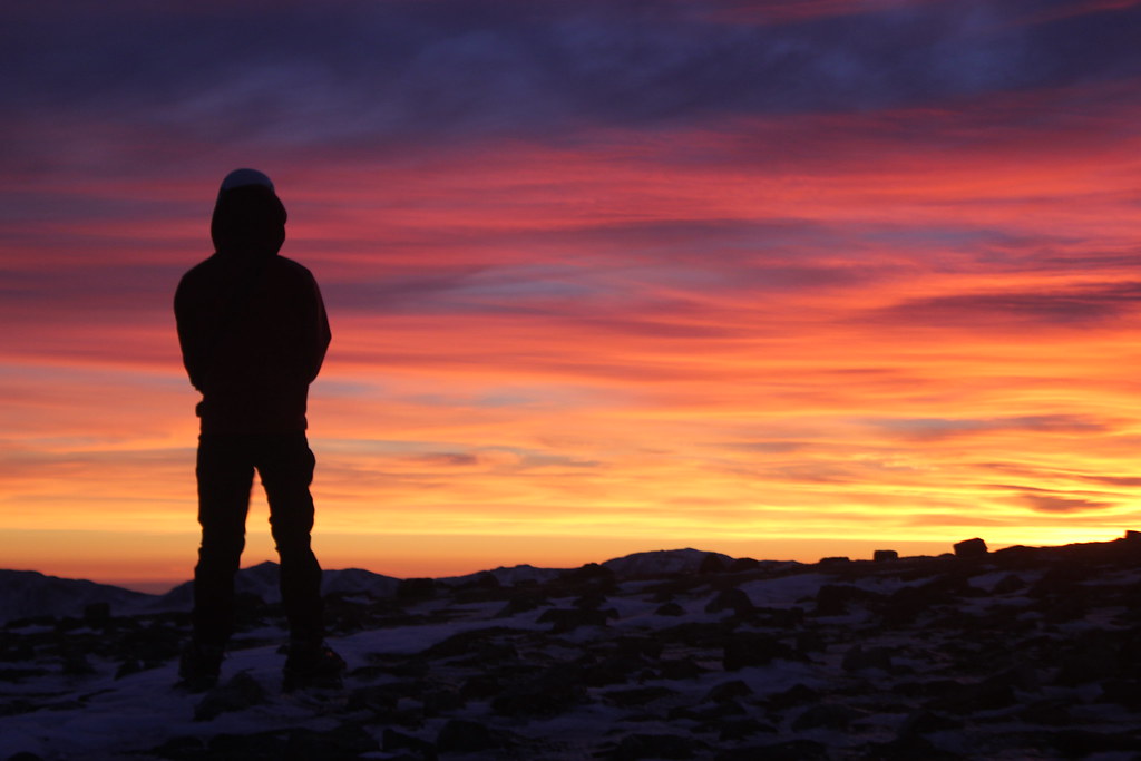
We set up the tent on the hut platform and ate and melted several litres of water from the snow. As the sun sank behind the mountain, the temperature dropped dramatically and the clouds cleared. The twinkling lights of Litochoro seemed very distant and the sea and sky seemed to merge together in a blue haze.

Distant lights

That night was very cold, but gave way to clear blue skies in the morning and with much lighter packs we set out, climbing at first through the woods before finding a way to cross the steep gully separating us from Chonderomesorachi, the ridge leading up to Skala and Skolio. At this time of the year, the snow has already melted from the south side of this ridge, exposing grey limestone scree, but mostly we walked on snow, up away from the trees. To the south, a group of snowy, remote 2500+m mountains, and ahead a heavily corniced ridge carrying us North towards Skala and Skolio.

Outlying Hills
In the snow

Still occasionally passing waymarks for the E4 long distance path, the ascent seemed to take far longer than its 2km and 800m suggested, and as we trudged ever higher, through every type of snow, the cloud we’d been watching on the hills over our shoulders started to creep up upon Mytikas and Skolio.

At Skala peak the ridge turns a corner once again and the thickening cloud told us we would not have time to visit more than one of the three big summits of Olympus. Mytikas is the highest and from here the Kaki Skala route looked every bit as inviting as had been suggested. There were some teams ahead of us now who had come up from the military ski-centre or Christakis hut on the South Western slopes of the mountain. So we decided to head for Mytikas. The other teams had clearly roped up here and we did the same, thought the route ahead was not supposed to be difficult, it was better to have some security on the descent to the saddle.

The Kaki Skala

At this point a couple of things became apparent, the architecture of this mountain was on a far bigger scale than either of us had imagined and we were racing an unknown force in the weather. The clouds brought warmer air that softened the snow and then snow as they lifted, this went in cycles.

The descent to the saddle was not hard but it was sensationally exposed, a slip here would have seen us being funnelled into the first snowy gully we crossed on the way to the hut the previous evening, some 1000m below. Protection was hard to come by in the shattered limestone, but the occasional bolt had been fixed by guides working on the mountain.

North face of Skala

From the col, the sense of scale and grandeur of these mountains is again heightened as the dramatic, steep, North face of Skala comes in to view and the South Flank of Mytikas looms up ahead. For a strong team, the face on Skala would hold dozens of long steep ice and mixed lines when conditions were good. We traversed another area of steep, soft snow to the right hand side of the ridge and began the ascent of a couloir to another smaller col. Here we had to cross the first of the teams in descent, of which there were three, each three men to a rope. The ridge here wound steeply about the top of a large chasm to its left and up steeper loose mixed ground on the side of a subsidiary spur. There were bolts which the guided parties were using, and provided convenient crossing points, but even so we lost probably an hour or more to the process of negotiating them on the most technical section of the route.

Looking down the route

Visibility was poor now, and as we climbed a short 45 degree snow slope, thankfully still quite icy, leaving the last of the guided parties below us and came to the summit of a large pinnacle. For a while we stopped, puzzled, unable to see any continuation of the ridge in the cloud, and with steep drops all around, for a while we thought we were stood on the very top of Greece. As another thin patch of cloud passed through, we realised our mistake and spied the main summit of Mytikas, with its metal Greek flag away to the north, not much higher, but perhaps 100m distant. We were separated from it by a narrow technical ridge blocked by a bulky Gendarme. The going would not be too hard, but it might take us an hour to bypass the difficulties and that would certainly mean undertaking most of the walk out from Skala in the dark. It was snowing again, but quite warm, and with no certainty about the weather, and only our tracks to guide us safely across the gully far below, benightment was not a thought either of us relished.

Tom at our high point

So we boldly turned tail and fled. From sub-Mytikas, about 20m shy of the true top of Greece, descending soggy, dubious snow interspersed with awkward rocky steps, using the occasional fixed gear or dodgy axe-belay where our 30m of rope would not carry us to the next rock. On the final exposed turn before the ascent to Skala, I placed three poor nuts in the chossy blocks, though I knew the ground ahead was easier.
Safely back on top of Skala, we quickly unroped, and eating on the move began descending the way we had come. The snow was much softer now, both melting and being covered by a new layer during the day, meaning we sank deeply or slipped sideways where we hadn’t done on the ascent. The mountains all around were no less magnificent, but we had learned new respect for them. The craggy peaks of Olympus are very much alpine in scale and deserve the same kind of treatment.

Halfway between Scotland and the Alps
After the gully crossing, a final short descent through beautifully atmospheric cedar forest brought us back to the hut platform at about 1930h, twelve hours after we left that morning and with about half an hour of daylight left, longer than our enormous walk in. Wearily we ate lunch and dinner in one sitting and put ourselves to bed. We had come a very long way from the sea to within a few metres of the highest point in Greece, before being driven down by the weather and lost time.

Back in the Forest

Exhausted

Neither of us savoured the idea of crossing the Zonaria to the far side of the canyon for the descent, especially having seen it strafed by large avalanches the day before, so we returned on the Monday, via the beautiful Enipea canyon, revisiting the holy spring of St. Dionysus and marvelling once again at the sheer scale and beauty, and loneliness of this place. The descent was long and warm and humid, with occasional outbreaks of rain, and quite long periods of ascent as we wove our way down out of the canyon and back into Litochoro, where we ate, filled our water and resupplied whilst the cloud finally lifted off the mountain and allowed us to see where we had been.

Shrine of St. Dionysus
The E4 path
The final hour or so back to the sea passed quite quickly, we were barely aware of the guard dogs, though on the descent of the canyon we noticed many things that we had been too exhausted and working too hard to see on our way up.

At the entrance to the park
Olympus dwarfs Litochoro


The final walk to the sea
Back at the coast

The receptionist at the campsite made us fruit tea, and failing to find an open bar or taberna by the coast, we ate some of our supplies and went directly to sleep, aware of a very hard job well done, but frustratingly not quite finished. Olympus will call us back, but whether we shall walk the entire length of the canyon again remains to be seen. There are easier approaches to the hill that would allow more time to be spent on the mountain itself and easier routes to the summit, though the harder looking, more technical ways, of which there look to be plenty hold more appeal. We shall return, and perhaps we shall meet the man whose path we crossed on a motorway bridge about 1km from the shore who had ridden his laden mountain bike there from Venice, through the Balkans and had allowed himself three days to cover the 450km or so to get his flight from Athens; he certainly seemed excited by our adventure, as we were by his.

Free of cloud
Provisions: 'Squeeze and Tap'